Cities around the world are expanding faster than ever. As populations grow and urban areas become more crowded, there is increasing pressure on city planners, architects, and developers to design smarter, more efficient spaces. One powerful tool making this possible is 3D rendering.
3D rendering is no longer just a tool used by architects for presentations. It has become an essential part of urban development. It helps professionals visualize entire city projects before a single brick is laid. With lifelike images and animations, 3D rendering allows teams to plan better, save money, and communicate ideas more clearly.
In this article, we’ll explore why the demand for 3D rendering in urban development is rising, how it is used, and what the future holds for this technology.
What is 3D Rendering in Urban Planning?
3D rendering is the process of creating realistic images or animations from architectural designs using computer software. These renderings show how a building or urban area will look in real life.
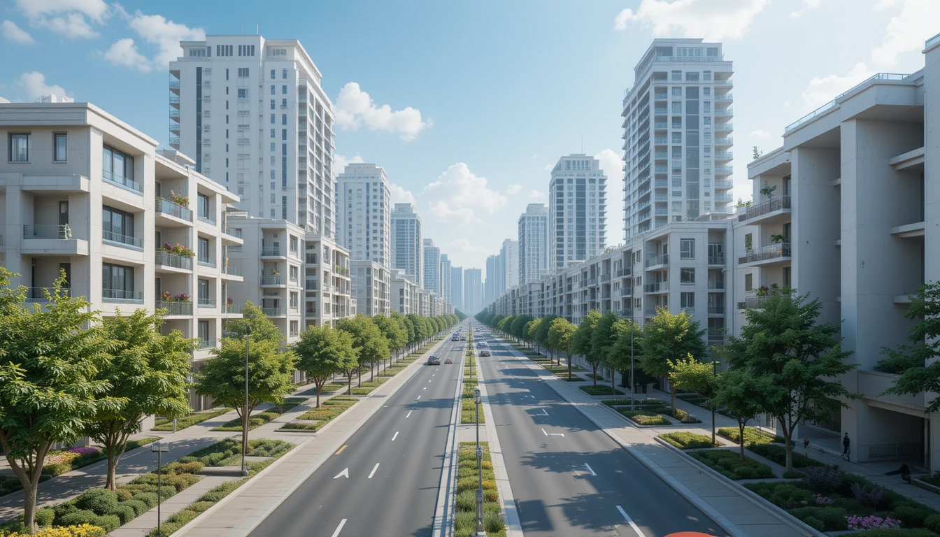
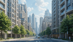
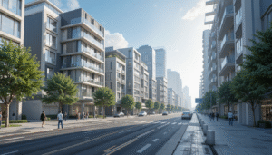
In urban development, this technology is used to design roads, parks, bridges, housing developments, shopping centers, and even entire neighborhoods. By turning 2D plans into 3D visuals, developers can present their ideas in a way that is easy for everyone to understand — from engineers and investors to city officials and the general public.
Why Urban Areas Need 3D Visualization
Modern cities are becoming more complex. There are more people, more buildings, and more systems that need to work together. Planners and designers need better tools to manage this complexity, and 3D rendering is one of the best tools available.
Here are some reasons why 3D rendering is so important in urban development today:
1. Clearer Communication
Most people find it difficult to read blueprints or understand flat, 2D maps. With 3D visuals, it’s much easier to see how a building or area will look once completed. This helps all stakeholders — including city officials, investors, and residents — to get a clear picture of what’s being planned.
2. Faster Approvals
When city councils or government bodies review a project, they want to see exactly how it will affect the community. 3D renderings give them confidence in what they’re approving, which can speed up the entire approval process.
3. Early Problem Solving
3D models can reveal design issues before construction begins. This means developers can make changes during the planning phase, saving time and avoiding costly mistakes down the road.
4. Better Public Engagement
When citizens can see what a future building or park will look like, they are more likely to support the project. 3D visuals help build trust and allow for feedback before any construction starts.
How 3D Rendering is Used in Urban Development
3D rendering is now used in almost every stage of urban planning and construction. Here are some common applications:
-
Transportation Networks: Roads, bridges, bus stations, and metro systems are designed and tested using 3D renderings.
-
Green Spaces and Parks: Designers can visualize how natural areas will blend with nearby buildings.
-
Residential Projects: From apartment complexes to gated communities, housing layouts are better understood through 3D visuals.
-
Commercial Buildings: Shopping centers, offices, and hotels are often rendered in 3D before construction.
-
Mixed-Use Developments: These include areas with a mix of homes, shops, and public spaces. 3D renderings show how everything will connect.
In the middle of these developments, many professionals rely on 3D building design renderings to ensure accuracy and improve collaboration. These detailed renderings help architects and planners present their ideas professionally and attract investment by showing exactly what the finished space will look like.
Benefits of 3D Rendering for Urban Projects
3D rendering offers a wide range of benefits that make it incredibly valuable for city development projects.
Improved Planning
Designers and engineers can better understand how different structures will interact with each other and the surrounding environment. This leads to smarter planning and more efficient use of space.
Cost and Time Savings
Mistakes in construction are expensive. 3D rendering helps prevent those mistakes by spotting problems early. It also reduces the number of revisions needed during the design phase.
Attracting Investors
A high-quality 3D visual can make a huge difference when trying to attract funding. Investors want to see exactly what they’re putting their money into, and renderings provide that confidence.
Sustainable Design
Planners can use renderings to test how buildings will respond to sunlight, wind, and other natural factors. This helps in designing energy-efficient buildings that are better for the environment.
Easy Collaboration
Multiple teams — including architects, engineers, city planners, and developers — can work together more effectively when they all have access to the same 3D model. Everyone stays on the same page, which leads to smoother project execution.
The Future of 3D Rendering in Urban Development
As technology continues to advance, the use of 3D rendering in urban development will only grow stronger. Here are a few trends shaping the future:
Real-Time Rendering
New tools allow teams to create interactive 3D models that can be updated in real time. This is helpful for presenting ideas to clients or making quick changes during meetings.
Integration with Virtual and Augmented Reality
Virtual reality (VR) and augmented reality (AR) are becoming more common in urban design. Imagine walking through a new neighborhood before it’s built, or seeing a building pop up on your phone screen just by pointing it at a map.
AI and Smart City Simulation
Artificial intelligence (AI) is being combined with 3D rendering to create smart city simulations. These models can predict traffic flow, energy use, and even public behavior — allowing planners to make smarter decisions.
BIM and GIS Integration
Combining 3D rendering with Building Information Modeling (BIM) and Geographic Information Systems (GIS) adds a new level of precision and context to planning. This helps teams design cities that are not only functional but also sustainable and adaptable.
Conclusion
The demand for 3D rendering in urban development is growing rapidly, and it’s easy to see why. This powerful tool helps planners, architects, and developers bring their visions to life. It improves communication, speeds up approvals, reduces errors, and engages the public.
As cities continue to grow and change, 3D rendering will play a critical role in shaping the urban spaces of tomorrow. Whether it’s designing a park, building a transportation system, or planning a smart city, 3D visuals make the process easier, faster, and more accurate.